
blah blah blah
Twin Mountain
Length: 11.5 miles out-and-backDifficulty (click for info): Extreme
Elevation Gain: 3360 feet (+300 feet on return)
Rating (click for info): 10/10
Elevation: 4902' (South) and 4761' (North)
Prominence: 1522' (South) and 301' (North)
Driving Directions:
Trailhead and parking area are at the end of Haystack Road in Bethlehem, NH (summits are in Franconia). Haystack Road leaves the south side of Rt. 3 7.4 miles northeast of Rt. 93 at exit 35 and 2.5 miles west of Rt. 302. The road is marked only with a hiking sign. Drive 2.5 miles to the parking area at the end of the road. Click here for a Google map.
About the Hike:
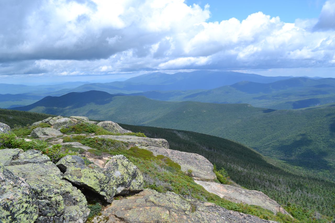
North and South Twin Mountain are not among the most popular peaks in the Whites, but they are absolutely contenders for the best view. North Twin features two ledges on opposite sides of the summit, one with a view to the east, over the Little River Valley to the Presidentials, and one with a view to the west, overlooking the western Pemigewasset Wilderness and extending out to Vermont horizons. South Twin, the higher of the two, has a wide open, rocky summit with breathtaking mountain views in all directions, including a unique view of the Bonds from the north. The price for the beauty of the Twins is long, arduous hike which involves nearly two miles of sustained, steep climbing.
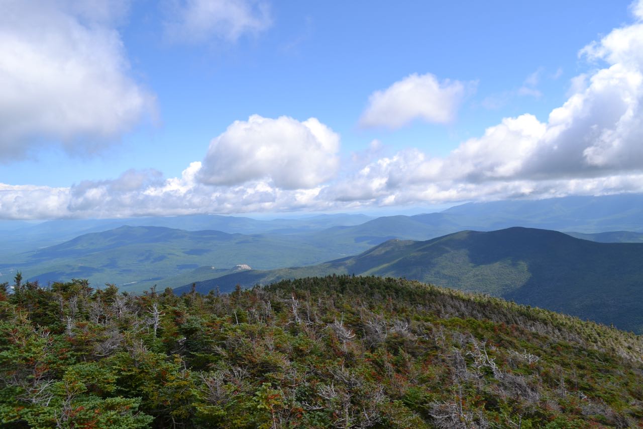
The hike begins with a long, easy walk into the Little River valley. The North Twin Trail leaves the parking area and heads gradually uphill on an easy dirt path. It follows an old railroad grade for 0.6 miles, crossing one small brook on a wooden bridge. It reaches Little River after 0.6 miles and follows it for 0.2 miles before crossing to the other side. Just before the crossing, bear left onto a herd path. This "crossings bypass" will allow you two avoid two crossings of the river on the official trail which are both unnecessary and very difficult (especially the first one), even at low water. The path is easy enough to follow, although many other herd paths do split off and rejoin. The easiest path usually stays close to the river, passing several scenic spots along the bank and crossing a small brook near the end. The "crossings bypass" rejoins the main trail immediately after its second crossing. This is 0.6 miles from the first crossing, only 0.1 miles longer than the main trail. Continue on North Twin Trail as it heads away from the river and climbs slightly. There are several ups-and-downs in this section, as well as one wooden staircase. After half a mile, just after a brook crossing, the trail crosses Little River. On the other side, it climbs up the bank and continues parallel to the river, gradually pulling away. It crosses several small brooks, then a larger one, and turns right to climb more steeply. After crossing a large but often dry stream, the trail becomes loose and rocky. It climbs relentlessly until 1.5 miles from the river, when it takes a left turn and briefly climbs across the slope, then turns back to the right to continue ascending. It climbs for 0.7 miles, first very steeply, then more moderately as it enters an open forest, with some minor rock scrambles near the end. It then reaches North Twin's eastern viewpoint ledge, which provides a sweeping view over the Little River valley.
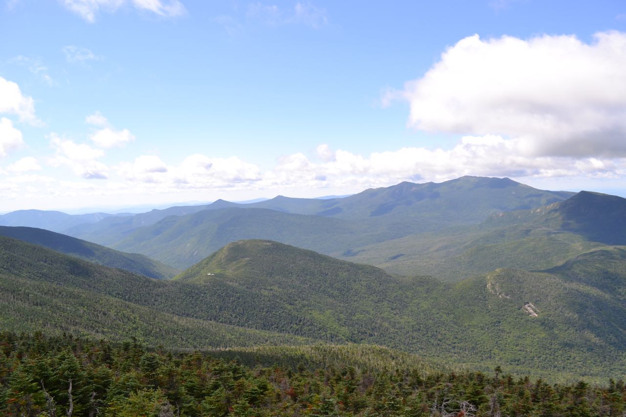
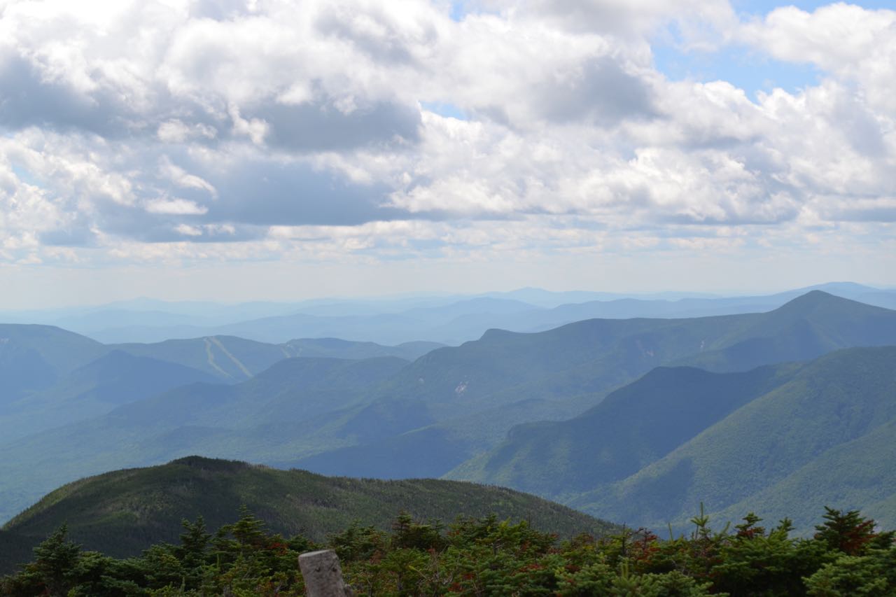
To the west-northwest, you look off into the distance to Vermont. To the north, you can see some of the ranges in Nash Stream Forest. Next over is Cherry Mountain, with the Pliny and Pilot Ranges behind, the two ledgy bumps of the Sugarloafs far below. The rest of the Cherry-Dartmouth Range is further to the east, behind and to the left of nearby Mt. Hale. To the east is the Presidential Range. The Willey Range rises in front of the Southern Presidentials and closest to you is the long, flat Zeale, connected to Mt. Hale on the left and Zealand Mountain on the right by long ridges. To the right of the Willey Range is the lower Montalban Ridge, including Stairs Mountain and Mt. Resolution, and other distant mountains, including Kearsarge North. Behind Zealand is the Nancy Range, with the Moat Range behind that. Mt. Carrigain is seen across Carrigain Notch from the Nancy Range. Mt. Chocorua is behind, above Vose Spur. Directly below you is an impressively sharp drop into the valley of the Little River's west fork. To the right of Carrigain, Mt. Passaconaway is seen in the distance, and Mts. Guyot and Bond appear just to the left of South Twin. Once you've finished admiring the view, continue on North Twin Trail as it runs perfectly level on an easy dirt path, then climbs gently to a trail junction in 0.1 miles. Turn right onto a spur path, which climbs over the summit of North Twin, then leads out to the western viewpoint ledge. This one commands a spectacular vista over the western Pemigewasset Wilderness. To the far left, you look up to the other side of South Twin. Southwest Twin peeks out from the side of South Twin, with Mt. Tecumseh, Scar Ridge, and Loon Mountain behind. To the south-southwest you look down the Franconia Brook valley at Whaleback Mountain, just to the right of Loon Mountain. From there, the Franconia Range rises to the north over Mt. Flume and Mt. Liberty. Owl's Head Mountain is below, and Galehead Mountain is even closer. Galehead Hut is visible in front of it. To the southeast are the higher peaks of the Franconia Range, Mts. Lincoln and Lafayette. Next to the right is Mt. Garfield, connected to Galehead by the bumpy Garfield Ridge. To the west, the view extends far into Vermont to the distant Green Mountains.
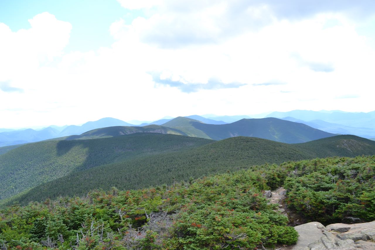
To continue to South Twin, return to the junction and turn right onto North Twin Spur. The trail descends gently, with a few good views ahead to South Twin. It soon becomes steeper and descends over a few rock scrambles before passing through a blowdown patch and reaching the col between the Twins in half a mile from North Twin. The fern-lined path then climbs moderately for 0.4 miles before emerging in an opening with a view ahead to the nearby summit. The trail then continues 0.2 miles to the summit. There are two crags from which to see the views; the summit of South Twin is on the southern one, along with a trail junction with Twinway. There are spectacular views in all directions from here. Now you can you can see to the south, down the ridge to the Bonds. Mt. Hancock is seen behind Mt. Bond. The Tripyramids are in the distance to the right of Hancock, with flat-topped Mt. Kancamagus below, just above West Bond. In the distance to the right behind West Bond is Sandwich Dome, with Mt. Osceola closer and to the right of that. Also new is the view to the north back at North Twin. A better perspective down to Galehead Mountain can be gained by walking a short distance down Twinway to the west (right).
Printable directions page